Common soil types
There is a variety of soils across Queensland. They are broadly grouped into soil orders based on the Australian Soil Classification system (ASC).
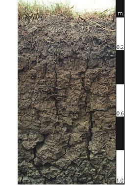
Vertosols
Vertosols are the most common soil in Queensland—characteristics include:
- brown, grey or black soils which crack open when dry
- they commonly form hummocky relief called gilgai
- very high-soil fertility—ability to supply plant nutrients
- large water-holding capacity.
They are cracking clay soils of the Darling Downs and Central Highlands. A large belt of grey and brown Vertosols run from the New South Wales border to Charters Towers—corresponding with Brigalow forests.
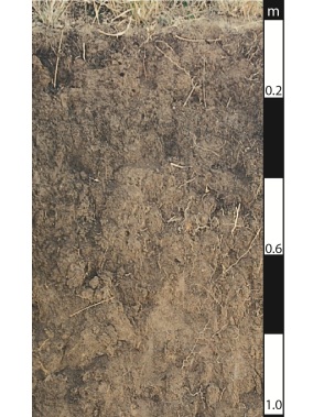
Dermosols
Dermosols are red, brown, yellow, grey or black and have loam to clay textures. This type of soil covers the higher-rainfall coastal and sub-coastal regions. Important areas of these soils are the Burdekin delta and the Lockyer and Fassifern valleys.
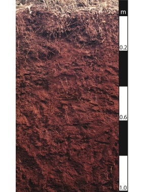
Ferrosols
Ferrosols are well-drained soils with red or yellow-brown colour and have clay-loam to clay textures.
This soil type is usually associated with previous volcanic activity and is mainly located along the Great Dividing Range. Large areas of these soils occur around Kingaroy and Atherton where they are used for intensive crop production.
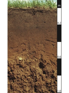
Chromosols
Chromosols are texture-contrast soils.
Extensive areas of Chromosols are in the Western Downs and the Maranoa districts—west of the Great Dividing Range.
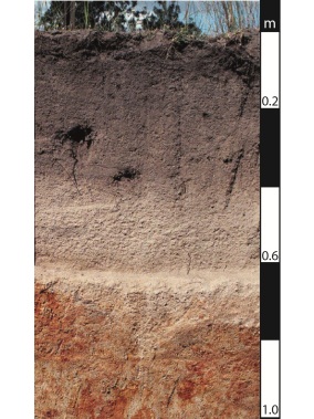
Kurosols
Kurosols are texture-contrast soils. They are strongly acid (pH below 5.5).
Kurosols occur along the coast, mainly in southern Queensland.
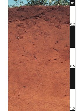
Kandosols
Kandosols are red, yellow and grey massive earths. They generally have a sandy to loamy-surface soil, grading to porous sandy-clay subsoils with low fertility and poor water-holding capacity.
A wide range of crops can be grown on these soils where rainfall is higher or where irrigation is available. Large areas of Kandosols exist around Charleville—corresponding with mulga vegetation—and support sheep and cattle grazing on native pastures.
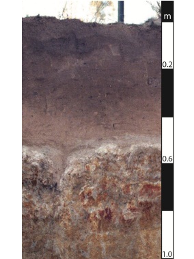
Sodosols
Sodosols are texture-contrast soils with impermeable subsoils due to the concentration of sodium. These soils occupy a large area of inland Queensland. Generally Sodosols have a low-nutrient status and are very vulnerable to erosion and dryland salinity when vegetation is removed.
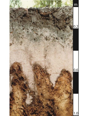
Podosols
Podosols generally have a low fertility and low water-holding capacity.
Podosols are mainly sandy soils with accumulations of organic materials and aluminium (with or without iron compounds)—often referred to as “coffee rock”—in subsoil horizons. Podosols occur in the more humid coastal regions including areas such as K'gari (formerly Fraser Island) and Shelburne Bay. Podosols occupy less than 1% of the state.
Arenosols
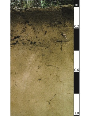
Arenosols generally have a low fertility and low water-holding capacity.
Arenosols are deep sandy soils with sand, loamy sand or clayey sand textures and few or no gravels to a depth of 0.8m or greater. Arenosols occur extensively in inland arid areas, in and adjacent to waterways and near to the coast. Note: Arenosols were added in the 3rd edition of the ASC published in 2021 and were previously included in Tenosols and Rudosols.
Tenosols
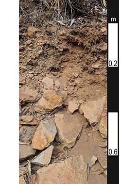
Tenosols generally have a low fertility and low water-holding capacity.
Tenosols have weak soil profile development. In the ASC, they are defined as having limited B horizon development (less than 15% clay content) but more development than the most rudimentary soils (i.e. Rudosols), including possible bleached layers and colour changes.
Tenosols are widespread and can be shallow and stony. The most extensive areas of these soils are inland from Cairns.
Hydrosols
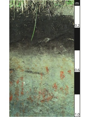
Hydrosols are soils that are saturated with water for long periods of time—typically a grey (or greenish-grey) colour.
This soil type covers less than 1% of the state and is mainly found near coastal areas. However, many inland wetlands are dominated by Hydrosols even though these areas may only be intermittently inundated.
Organosols
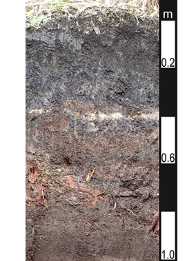
Organosols are dominated by organic materials—commonly referred to as peats. They do not exist in large areas in Queensland but occur as small pockets in the more wet areas—along the humid coastal environment.
Calcarosols
Calcarosols are lime-rich soils with sandy or loamy textures that may become more clayey with depth. They cover less than 0.5% of the state and occur in the arid western areas of Queensland; on calcium-rich sedimentary rocks, limestone and windborne deposits.
Rudosols
Rudosols generally have a low fertility and low water-holding capacity.
These are often shallow, stony soils with little more than some minor organic matter accumulation on the surface and weathered parent material.
Rudosols are poorly developed but widespread. The most extensive areas of these soils are inland from Cairns.
Soils and land use
A good soil is hard to define as it depends on its intended use.
A productive soil, that will support healthy plants, has several characteristics:
- deep
- well structured (see soil structure)
- fertile (see soil fertility)
- well drained (see soil water)
- biologically active
- of medium pH (see soil pH).
To help land managers determine land use options for their soil, a series of soil maps, land resource bulletins and land management manuals have been prepared for most parts of Queensland.