


Cape York Peninsula Heritage Area Biodiversity Planning Assessment
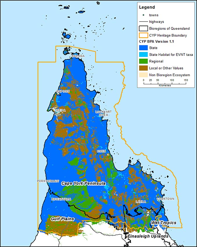
A Biodiversity Planning Assessment (BPA) is available for the Cape York Peninsula (CYP) Heritage Area. This assessment was completed in line with the CYP Regional Plan. The CYP Heritage Area follows the general boundaries of the CYP bioregion but extends slightly into the neighbouring Gulf Plains, Einasleigh Uplands and Wet Tropics bioregions (figure 1).
- Bioregion
- Cape York Heritage Area
- Access the BPA spatial dataset and associated reports
- View the Summary and Expert Panel report version 1.1 (PDF, 3.26MB).
- Release version
- 1.1
- Release date
- 9 December 2012
For further information email biodiversity.planning@des.qld.gov.au