Cats Claw Creeper vine management case study
Disaster Recovery Funding Arrangements Environmental Recovery Program – Weeds and Pest Sub-program, 2021–22 severe events program
Riparian zones provide a range of important ecosystem services that benefit communities and agricultural business such as stabilisation and protection of channel banks, flood buffering, climate regulation, water filtration, refuge for regional species and supporting primary productivity. Weed invasion in riparian zones can destabilise riverbanks by displacing or smothering the native vegetation, impacting the plants’ ability to bind the soil profile and minimise soil movement.
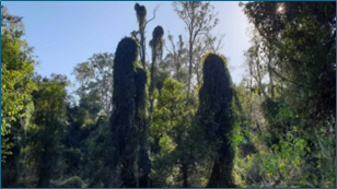
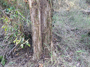
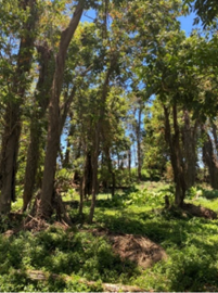
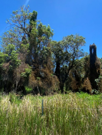
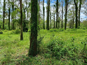
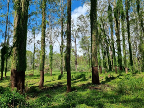
Following flooding across South East Queensland in 2021–2022, Seqwater identified new weed infestations at five sites in the Stanley River, Mid-Brisbane River and Logan River headwaters through helicopter surveys and on-ground inspections. These new infestations were considered to pose a risk to the health of riparian zones, with Cat's Claw Creeper vine (Dolichandra unguis-cati) being of particular concern due to its invasive nature and tendency to smother standing vegetation and trees, resulting in canopy collapse.
The project was supported by the jointly funded Commonwealth-State Disaster Recovery Funding Arrangements - Environmental Recovery Program (administered by Department of the Environment, Tourism, Science and Innovation). Seqwater were awarded a $412,500 grant under the Weeds and Pest Management sub-program to target areas affected by the severe weather events and where weed infestation had been exacerbated by the floods.
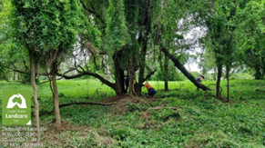
Seqwater partnered with Healthy Land and Water (HLW) to carry out on-ground works. HLW are the regional natural resource management group for South-East Queensland. HLW engaged with 27 landholders to obtain access prior to commencing treatments.
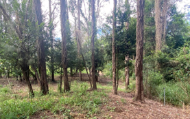
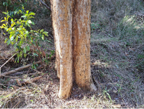
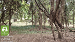
A total of 45.1 hectares was successfully treated, stretching 15km of riverbank across these 27 properties. The project resulted in the reduction of Cats Claw Creeper vine across these sites to a manageable level (refer before and after images below) which will continue to be maintained under the Seqwater regional riparian weed control program.
Techniques used for weed control included foliar spraying with herbicides, double cut stump (removal of a vertical section of vine from tree trunk with herbicide applied to vine stems still attached to the root) and hand pulling. Access to the sites was difficult, with transport of staff and equipment from access points to treatment areas being on-foot and across dense and steep terrain. The work effort required is summarised below:
- 20 workers from subcontractor Barung Landcare carried out work over 16 days.
- 8 workers from subcontractor Technigro carried out work over 35 days.
- 10 workers from subcontractor Ausecology carried out work over 22 days.
- 7 workers from subcontractor Cedar Grove Landcare carried out work over 7 days.
Feedback from landowners was positive and many have expressed a desire to continue with weed management programs through future partnerships with Seqwater. An ongoing monitoring programme will be key to ensuring the control of riparian weed regrowth and the sustainability of the project over time, with some ongoing management already occurring.