A simulated pollution event
A pollution event happens when the concentration of pollutants exceeds acceptable standards.
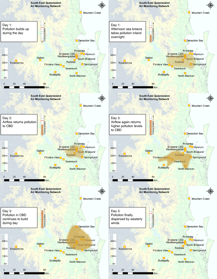
The animated illustration shows a simulation of how a pollution event may develop over several days across South East Queensland, given weather conditions that promote air pollution.
You can follow the movement of pollutants in the contaminated air parcel and track the change in concentrations in the bar graph.

A simulated pollution event—view pdf version (PDF, 1.1MB).
Day 1
The animation shows the build-up of pollutants throughout the first day of the event over Brisbane’s central business district (Brisbane CBD) due to high traffic levels and minimal wind movement. Later in the day, the afternoon sea breezes move the air parcel inland.
The surrounding topography (shown by the contours in the diagram) traps the pollutants in the valleys where they remain overnight. This is why there are monitoring stations located in places such as Mutdapilly and North Maclean, far from the Brisbane CBD.
Day 2
During the second day, airflows return the contaminated air parcel back to the Brisbane CBD where the same sources raise the levels yet again.
The sea breezes recirculate the air parcel with a higher concentration of pollutants back to the inland valleys for a second time. Then drainage airflows return them to the Brisbane CBD once again the following day.
Pollutant concentrations higher than acceptable standards are more likely when this pattern of recirculation occurs, intensifying contamination of the air parcel.
Day 3
On day 3, stronger winds finally disperse the contaminated air parcel by taking the pollutants out to sea, where dilution with clean air reduces the levels of pollutants. This can also occur if winds take the air parcel far inland.


