Guides for flood studies and flood mapping
The following guidance materials are to support Queensland's local governments, flood practitioners and disaster management groups with flood studies and flood mapping.
| Title / Cover / Link | Description /Source / Contact |
|---|---|
Guide for flood studies and mapping in Queensland (PDF, 2.54MB)
| The Guide for Flood Studies and Mapping in Queensland (2017) promotes a consistent approach to flood studies and mapping throughout the state. The guide is primarily intended to assist Councils and other floodplain management entities (such as river improvement trusts). Engineering consultants and other agencies involved with flooding may also use the guide when bidding for or preparing flood studies, or when interpreting flood study outputs. It is anticipated that all users have some technical background, preferably in engineering, land use planning and / or disaster management. NOTE: This guide is currently under review and due to be replaced by September 2025. If you wish to be consulted during this process, please contact us. Source: Department of Local Government, Water and Volunteers |
Flood Mapping Implementation Kit (PDF | 877KB) | The Flood Mapping Implementation Kit (2014) assists local councils and disaster management groups to use flood mapping products to improve their disaster management and land use planning. It aims to encourage effective use of available flood information to:
Source: Department of Resources |
Brisbane River Catchment Regional Guideline for Flood Awareness Mapping and Communication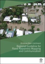 |
The Brisbane River Catchment Regional Guideline for Flood Awareness Mapping and Communication provides non-mandatory guidance to support delivery of regionally consistent council flood information to improve community awareness and resilience to floods in the Brisbane River catchment. Developed in
collaboration with the four councils, the regional guidance supports council provision of consistent online flood awareness mapping, property-scale flood information, place-based installations, and community facing language and messaging across the catchment. Whilst developed specifically for the Brisbane River Catchment, the guideline has purposefully been developed with consideration for statewide application. It is produced as a “living document”, intended for ongoing monitoring and review to ensure alignment with best practice, developments and innovation. Source: Queensland Reconstruction Authority Email: floodteam@qra.qld.gov.au |
Flood resilience strategies and plans
Examples of flood resilience strategies and plans in Queensland:
| Title / Cover / Link | Description /Source / Contact |
|---|---|
Burdekin and Haughton Flood Resilience Strategy
| A locally-led and regionally-coordinated strategy for flood resilience in the communities of the Burdekin and Haughton regions. The Queensland Government has also partnered with the Burdekin Shire Council and Charters Towers Regional Council to deliver the 2022 all hazards Burdekin and Charters Towers Regional Resilience Strategy which harnesses local expertise to champion a holistic approach to disaster resilience for the region. |
Brisbane River Catchment - Strategic Floodplain Management Plan and Flood Studies
| The Queensland Government and local councils have worked together to deliver on a long-term plan to manage the impact of future floods and enhance community safety and resilience in the Brisbane River floodplain. This program is a partnership between the Queensland Government, Seqwater and the four local governments of Brisbane, Ipswich, Somerset and Lockyer Valley. |
Burnett Catchment Flood Resilience Strategy
| The Burnett Catchment Flood Resilience Strategy was delivered in May 2018 to provide a consistent and coordinated approach to managing flood risk and to enhance community safety and resilience in the Burnett River Catchment. This Strategy was developed by the Queensland Government via the Queensland Reconstruction Authority (QRA) in partnership with Bundaberg Regional Council, Cherbourg Aboriginal Shire Council, North Burnett Regional Council, and South Burnett Regional Council. Implementation of the strategy is being overseen by the Wide Bay Burnett Regional Organisation of Councils. The all hazards Burnett Regional Resilience Strategy was published in 2022. |
